Río Fucha
Nombre del concurso / Name of the competition:
Concurso público de ideas para la formulación del plan estratégico de intervención integral y multisensorial para el Río Fucha y su área de influencia / Public contest of ideas for the formulation of the strategic plan of integral and multisensory intervention for the Fucha River and its area of influence.
Lugar / Location:
Bogotá, Cundinamarca
Cliente / Client:
Secretaria Distrital de Planeación. Ciudad de Bogotá
Programa / Program:
Espacio Público – Plan Maestro
Longitud / Length:
22 km
Equipo / Team:
Cauce
Colaboradores / Collaborators:
David Mesa
Osman Marín
Daniel Zuluaga
Juan Diego Martínez
Carolina Zuluaga
Sara Paris
Andrés Velázquez
Sebastián González
Alejandro López
Año / Year:
2015
Estado / State:
Tercer Puesto
Descripción / ES
Bogotá es una ciudad de una gran extensión y con muchos habitantes. Las ciudades de gran magnitud, que tienden a colapsar en movilidad, necesitan cada vez más soluciones de vivienda y servicios; esto se traduce en una densidad de construcción desbordada y absurda sobre el territorio. Esta densidad de construcción minimiza y estrangula por completo el porcentaje de espacio público óptimo de metros cuadrados por habitante; así, la ciudad se convierte en un sistema artificial que destruye cada vez más su entorno natural, en la cual sus condiciones de habitabilidad no son óptimas para el hombre.
Los sistemas hídricos que atraviesan ciudades adoptan un carácter urbano y adquieren, debido al desarrollo urbano desbordado, un estigma social y cultural; lo cual se traduce en problemas de condiciones inurbanas, de contaminación, inseguridad, destrucción del territorio y el ecosistema, colapsos en movilidad, y carencias de espacios públicos. Lo más preocupante es el desconocimiento y el olvido, que, como ciudadanos, le hemos dado a estos sistemas hídricos y bióticos; convirtiéndolos en espacios muertos, no-lugares, lugares peligrosos, no reconocidos por los habitantes. Por tanto, se hace urgente promover la re-significación y el reconocimiento de estos sistemas, recuperando así su carácter de ordenadores territoriales y reencontrando a sus habitantes con su territorio.
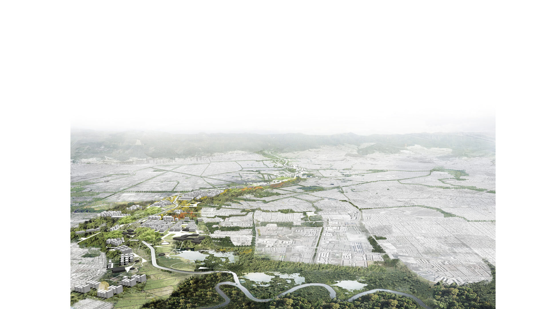
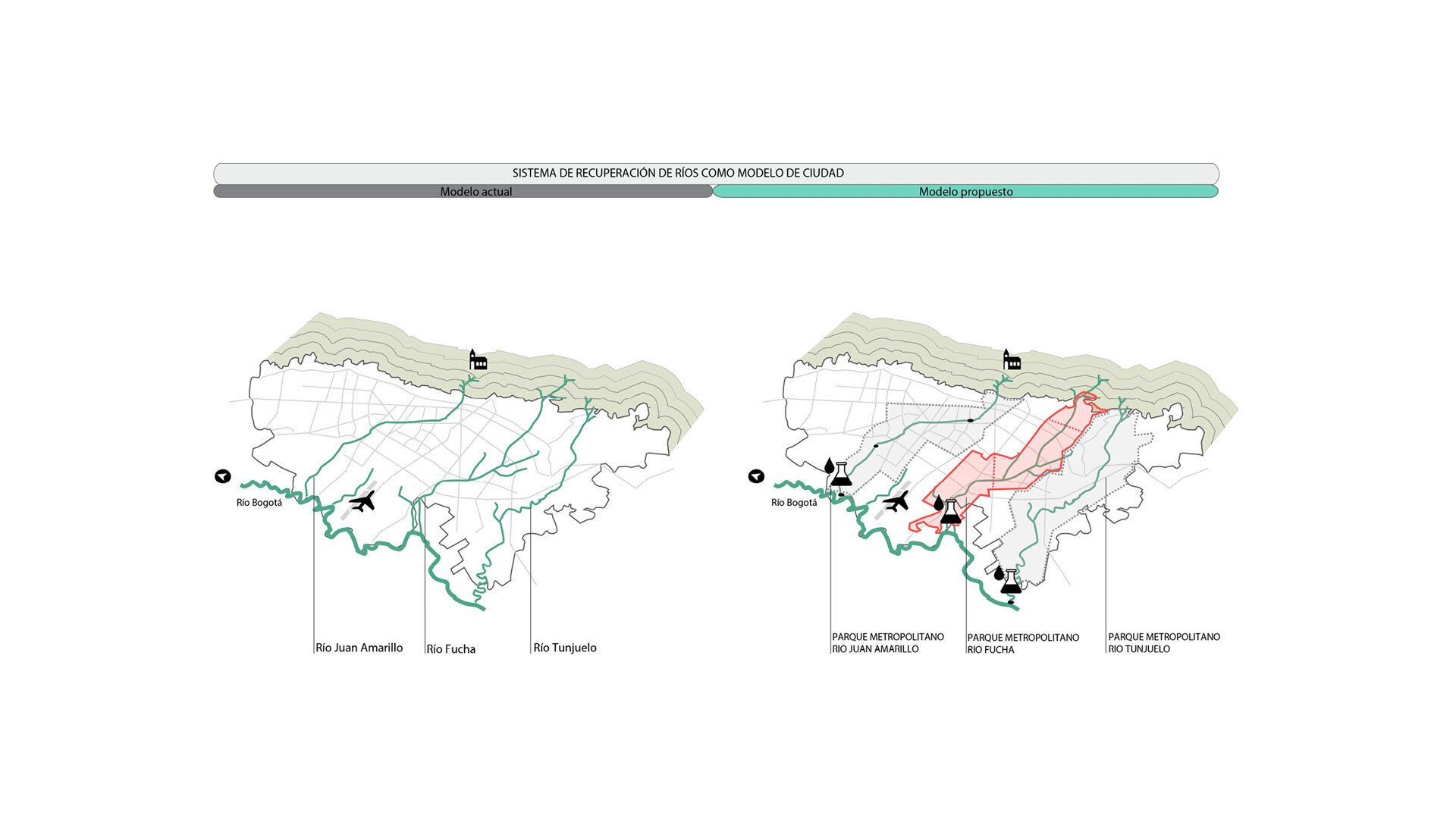
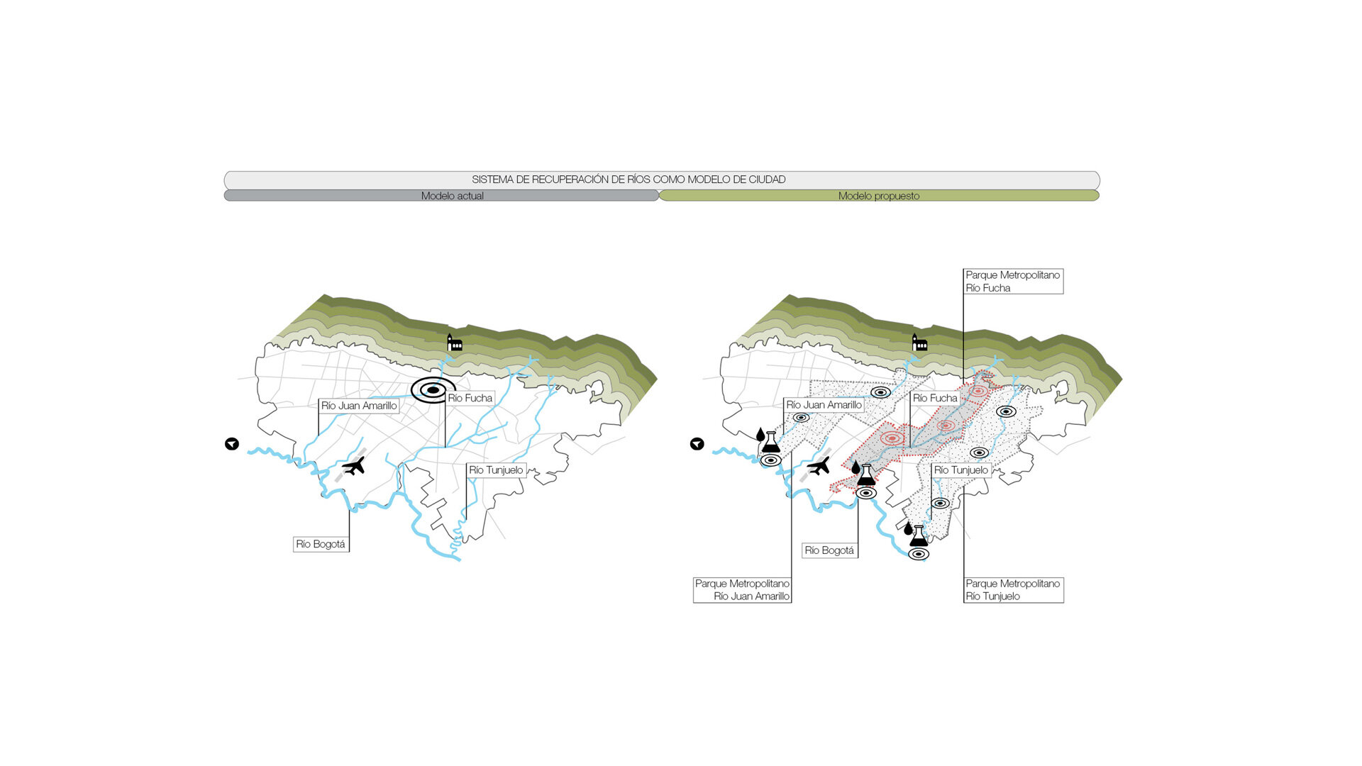
Para entender una ciudad como Bogotá se debe analizar su condición territorial, natural y geográfica; una capital establecida en una llanura, contenida por dos sistemas naturales muy fuertes: los Cerros Orientales y el Rio Bogotá en el Occidente. Entre estos se encuentra la ciudad, donde cruzan transversalmente tres ríos: Tunjuelo, Arzobispo y Fucha. Estos ríos, como sistemas hídricos, se deben proteger y potenciar, pues son la pieza clave para tejer la biodiversidad entre el Rio Bogotá y Los Cerros.
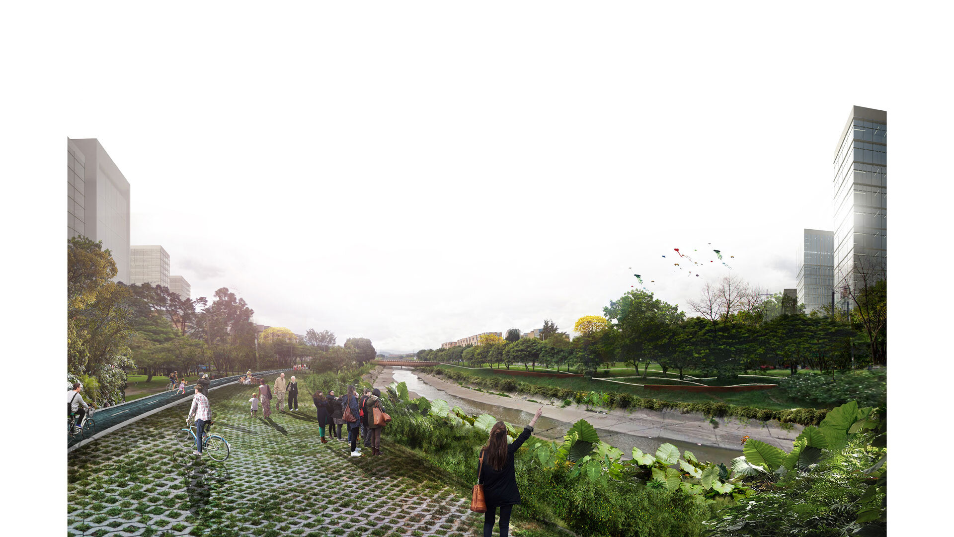
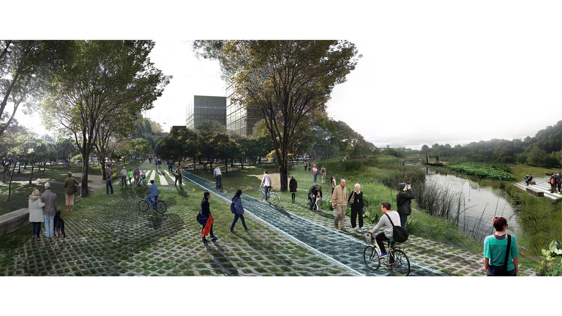
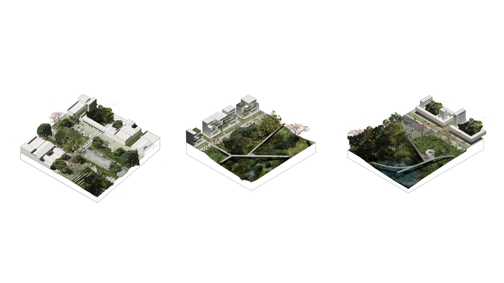
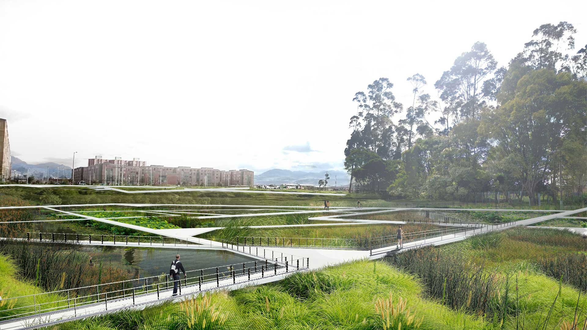
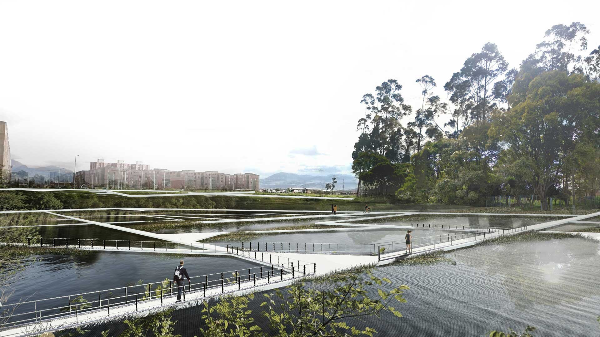
Es vital, para el futuro desarrollo de Bogotá, entender los sistemas naturales estructurantes y generar una planificación urbana territorial entorno a estos sistemas. Si se planifica la ciudad en coherencia con estos sistemas naturales, es posible potenciar sus sistemas bióticos y generar una ciudad más sostenible; donde los habitantes puedan relacionarse con su territorio, en ambientes naturales, sin tener que salir de la ciudad. Recorrer en bicicleta un sistema de humedales, tomar una caminata ecológica hacia el nacimiento de los ríos, o simplemente, apreciar y convivir con la naturaleza cercana a la arquitectura.
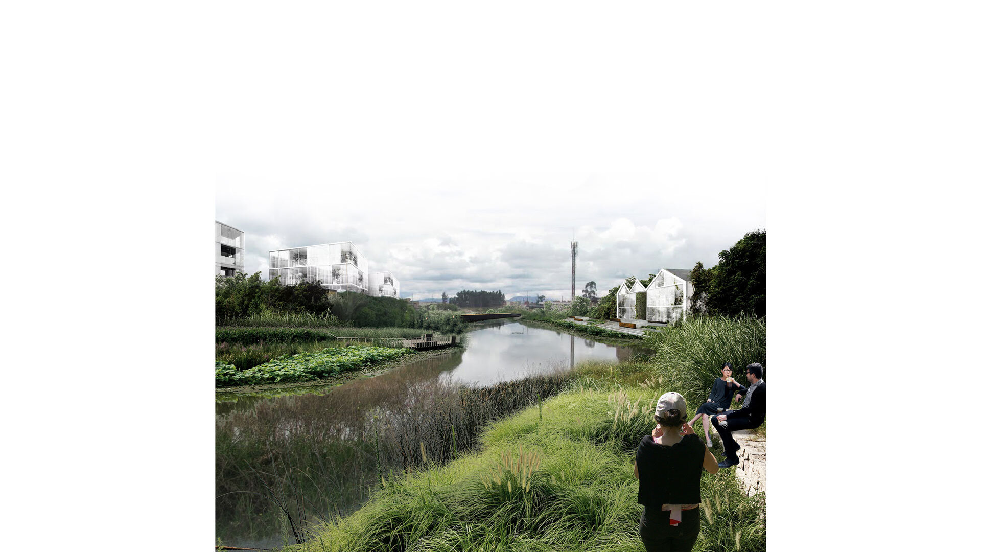
Si se piensa la planificación a partir del paisaje y los sistemas naturales, se obtienen ciudades más habitables y equilibradas, en donde la naturaleza se convierte en parte esencial del habitar y no en un territorio olvidado y peligroso, un patio trasero, un no-lugar de la ciudad.
Description / EN
Bogotá is a city of great extension and with many inhabitants. Large cities, which tend to collapse in mobility, increasingly need housing solutions and services; This translates into an overflowing and absurd construction density over the territory. This construction density minimizes and completely strangles the percentage of optimal public space of square meters per inhabitant; Thus, the city becomes an artificial system that increasingly destroys its natural environment, in which its habitability conditions are not optimal for man.
The water systems that cross cities adopt an urban character and acquire, due to overwhelmed urban development, a social and cultural stigma; which translates into problems of urban conditions, pollution, insecurity, destruction of the territory and the ecosystem, collapses in mobility, and lack of public spaces. The most worrying is the ignorance and oblivion, which, as citizens, we have given to these water and biotic systems; turning them into dead spaces, non-places, dangerous places, not recognized by the inhabitants. Therefore, it is urgent to promote the re-significance and recognition of these systems, thus recovering their character of territorial computers and rediscovering their inhabitants with their territory.
To understand a city like Bogotá, its territorial, natural and geographical condition must be analysed; a capital established in a plain, contained by two very strong natural systems: the Eastern Hills and the Bogotá River in the West. Among these is the city, where three rivers cross transversely: Tunjuelo, Arzobispo and Fucha. These rivers, as water systems, must be protected and strengthened, as they are the key piece to weave biodiversity between the Bogotá River and the Hills.
It is vital, for the future development of Bogotá, to understand the structuring natural systems and generate territorial urban planning around these systems. If the city is planned in coherence with these natural systems, it is possible to strengthen its biotic systems and generate a more sustainable city; where the inhabitants can relate to their territory, in natural environments, without having to leave the city. Cycle through a system of wetlands, take an ecological walk towards the source of the rivers, or simply, appreciate and live with the nature close to the architecture.
If planning is considered based on the landscape and natural systems, more habitable and balanced cities are obtained, where nature becomes an essential part of living and not in a forgotten and dangerous territory, a backyard, a non-place from the city.
